Note: Maps below courtesy of the National Park Service.
Overview
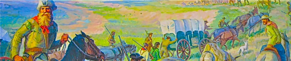
The Cimarron (“wild” in Spanish) Route or Road was the most favored route. It was approximately 770 miles long from Independence MO to Santa Fe NM and took an average of 62 days to cover by a typical wagon train – if everything went basically as planned.
This route was also known as the “dry” route because of the total lack of water for some 60 miles after it departed from the Arkansas River to head southwest. And that was during the normal years. If the year was a drought year, which it often was, the availability of water at the Cimarron River (Wagon Bed ) springs was often in doubt and the next expected water was some 20 more miles further south west along the trail. To put things into perspective, a typical wagon train could manage 12 to 20 miles per day. So, just to make it to Wagon Bed springs meant a dry four to five day journey . Each wagon carried two barrels of water for the animals. The people carried canteens. Normally the two barrels, together, would be consumed in two to three days by the animals. So by the end of a five day journey the animals would be desperate for water after having gone one to two days without water. If Wagon Bed springs was dry then they would have go an additional two days more without water. Most mules or oxen could not last that long without water to sustain them. The history of that part of the Trail was replete with stories of the number of abandoned wagons and dead animals along side of the trail.
In addition, this route passed through Indian territory and the wagon trains were subject to raids. For the most part the Indian were raiding to drive off the train’s livestock and to pick-off any lone or small groups of wagons.
Periodically, especially during droughts and indian troubles, the 100 mile longer and much more rugged Mountain Route was used.
Please see “The Mountain Route” displayed in this website for a map of that route.
Note: When visualizing the Santa Fe Trail or Road it is important to understand that it was not a road such as a highway or road is today. The many thousands of heavy wagons and their average of some six draft animals (some times up to twelve or more animals) chewed-up the dirt road so badly that, in order to avoid the deep ruts, the following wagons spread out which made the trail up to four or five miles wide in some locations such as found even today at Ft. Union New Mexico. In addition the total Trail including the various short-cuts (cut-offs), military roads, connecting roads as well as the two main routes exceeded 1,600 miles in collective length. A good way to see this fact illustrated is to view the Trail on Google Earth. The best place to begin viewing is the area around Ft. Union and then going northeast toward Clayton New Mexico.
 GIS NPS
1848 – 1860 GIS NPS
1861 – 1864 
GIS NPS
1865 – 1866
THE EARLY ROUTE 1822-1846 (The basic route was the same from 1822 to 1846) |
The dotted line below represents the border between Mexico and the US prior to 1846.
According to family stories my grandfather and his wife drove a Conestoga wagon from Michigan to Clayton NM around 1905. Would he have taken the Cimarron loop at that time or more northern route?